Map of Proposed Destruction
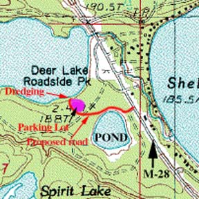
Map of Proposed Destruction
The red line drawn in on the map indicates where the proposed road will come in from highway M-28, travel along the north shore of the Pond, and then cut through the forest to Deer Lake
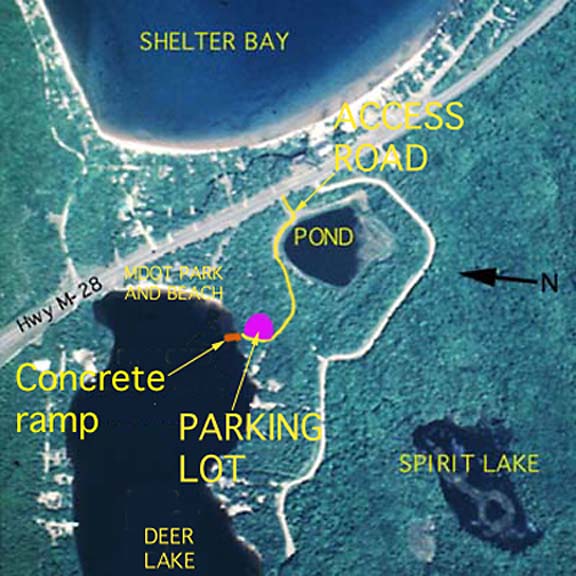
Below is an aerial photo of Shelter Bay and the east end of Deer Lake showing where the access road, parking lot, and concrete ramp would be constructed.
![]()